Scarr Summit from Roundwood & Wild Camp
Planning to hike Scarr Mountain? Here is a complete guide to this 20km Wicklow route, including where to camp, what gear to bring, and how to navigate the bogs.
I filmed this entire hike. Watch the full video and get the behind-the-scenes story on my Patreon: patreon.com/iainhikes
What This Hike Is and Who It Is For
I recently packed my gear and headed to the Wicklow Mountains for a two-day, 20-kilometer hike. The route starts near Roundwood, climbs over Scarr Mountain, drops into the Glenmacnass Valley, and finishes with an ascent of Tonelagee. I planned to camp overnight on the summit.
This is a challenging route. You need strong navigation skills, good fitness, and the right equipment. The ground is heavily waterlogged on the approach to Scarr summit, and you will spend time walking through the bog. If you want a paved tourist path, skip this one. If you want wild, open mountains and total quiet, this is exactly what you are looking for.
Route Overview
Start Point: Roundwood via the St Kevins Bus Service from St. Stephen’s Green in Dublin. You can take luggage on this! I couldn’t find any details about it on the internet, but the coach has a luggage compartment to stow your bag.
End Point: Laragh or Glendalough (Laragh via Military Road, Glendalough via the Tonelagee Summit -> St Kevin’s Way.
Total Distance: Approximately 20 km.
Days Required: 2 days if wild camping.
Section-by-Section Breakdown
The Trailhead and Woodland
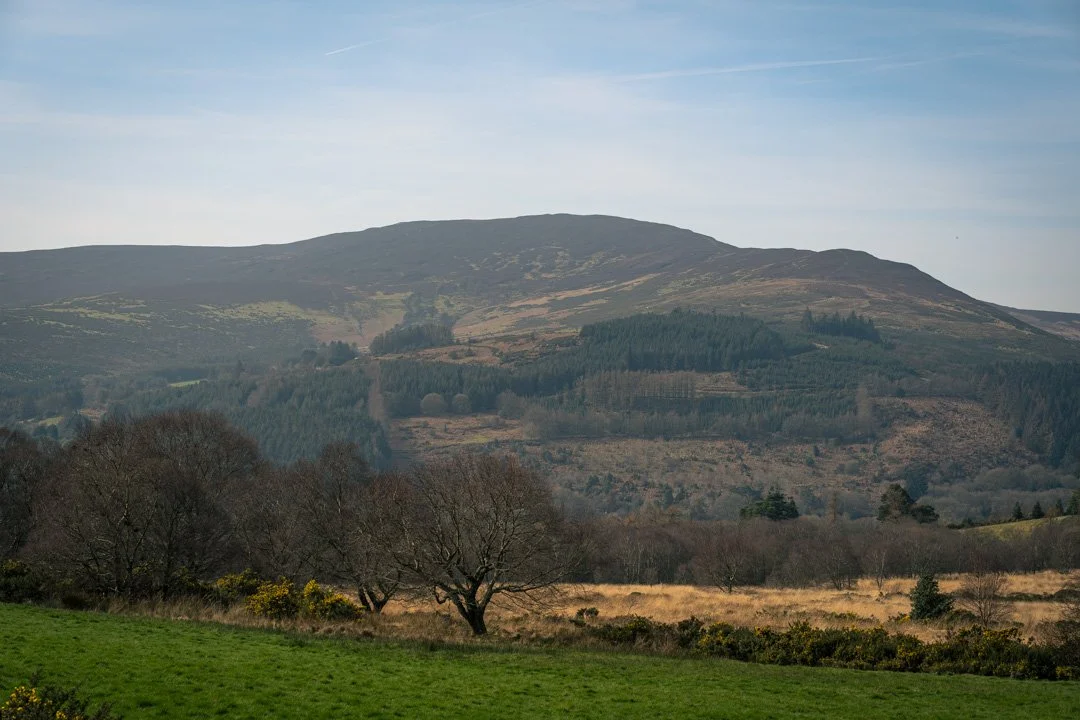
The hike starts on a paved country road near Roundwood. Roundwood is one of the highest villages in Ireland at 238 meters above sea level. It is a great place to buy food before you head out.
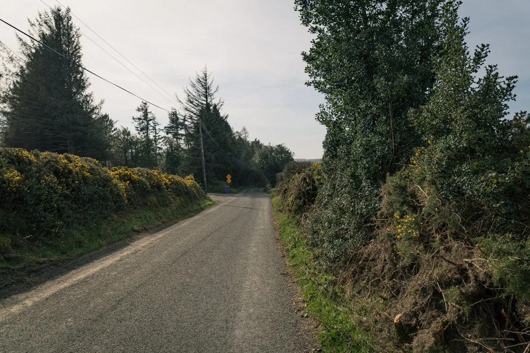
The first section of the trail leaving Roundwood is on paved roads.
From the road, you step onto a dirt path right next to the Lough Dan National Scout Campsite. The trail climbs steadily through a pine and birch forest. It is sheltered and quiet here. About a kilometer in, you pass a primitive wooden A-frame shelter. I did not test it for rain cover :) but it is a good visual marker that you are on the right path. The path gets narrow and pushes through dense, spiky gorse. You definitely want to wear tough trousers.
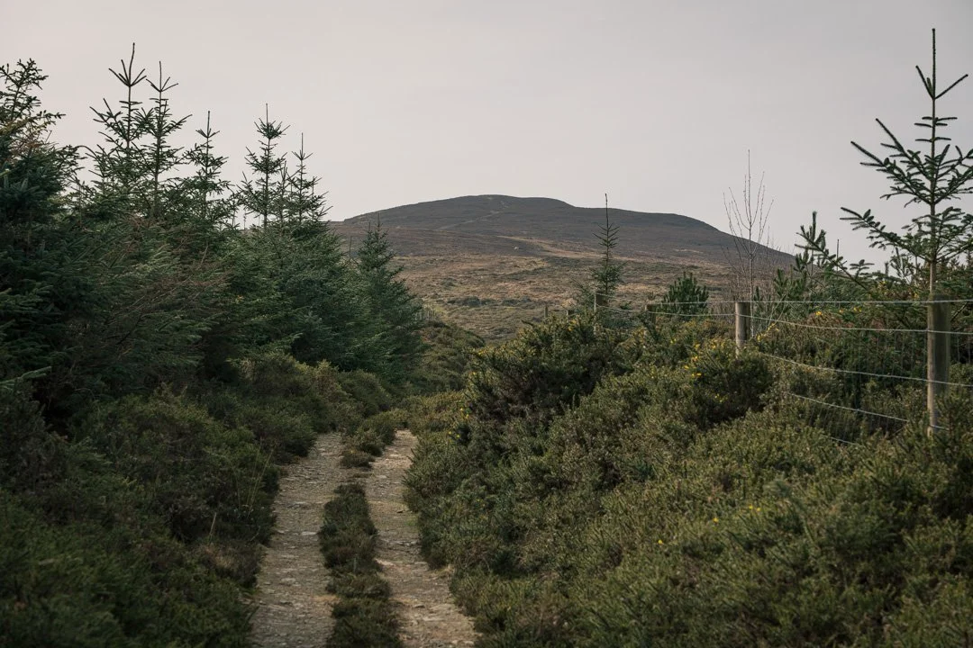
The wonderful forest path that opens up to Scarr’s summit.
Ascending Scarr Mountain
You leave the tree cover and step onto the open hillside. After this point, you are on your own for navigation.
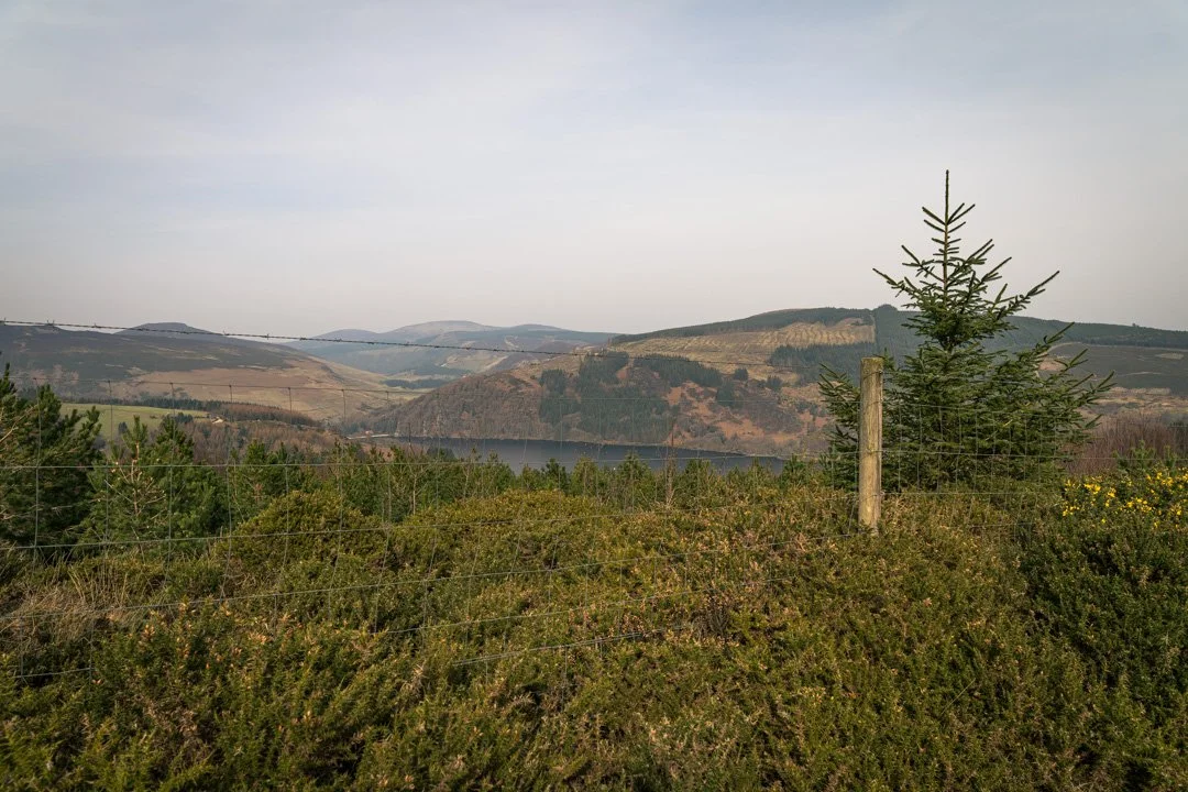
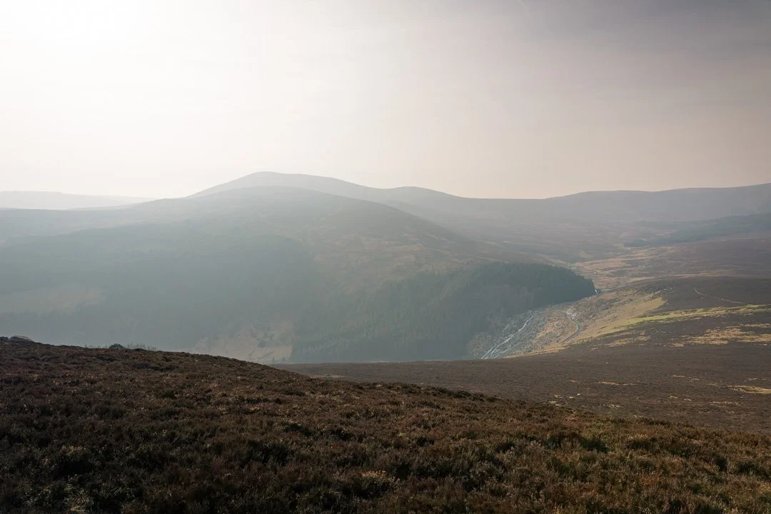
As you climb higher, the defined trail gives way to open moorland, and gets very steep and muddy. Look back over your shoulder for excellent views of Lough Dan through the trees, and the massive Vartry Reservoir further east. The reservoir supplies 80 million liters of water to Dublin every day.
At 641 meters, you hit the summit of Scarr Mountain. You get a 360-degree view of the Wicklow Mountains. You can also see your next big target across the valley: Tonelagee.
Descending to the Glenmacnass Valley
Leaving Scarr, you drop down the western side into the valley. The ground here is completely saturated. You cross from the eastern ridges into the wilder central spine of the mountains.
At the bottom, you meet the Glenmacnass River and the Military Road. The British Army built this narrow, paved road in the early 1800s to hunt down Irish rebels after the 1798 Rebellion. You have to cross the river using large boulders as stepping stones. These rocks are covered in moss and are pretty slippery. Take your time.
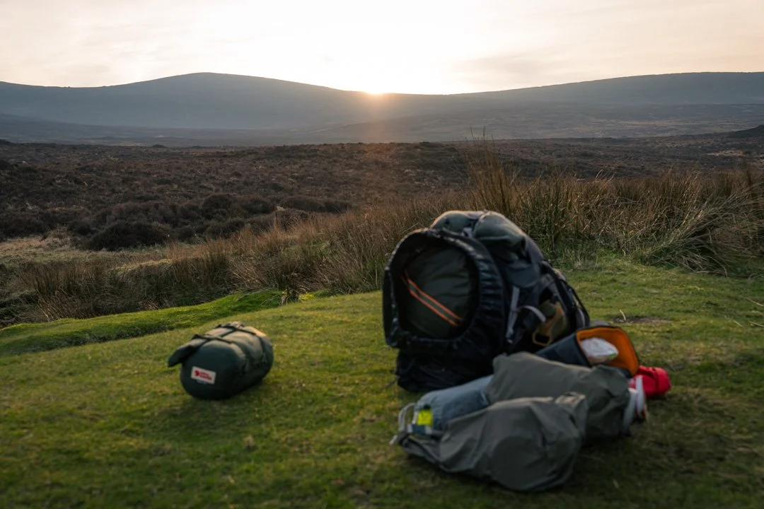
Camping at Lough Ouler Brook
I set up my tent on a flat grassy patch next to the Lough Ouler Brook. This brook drains water from Lough Ouler down into the main river.
Lough Ouler is a famous corrie lake formed by glacial erosion during the last Ice Age. From above, it looks exactly like a heart!
Practical Information
Parking and Access
There is no large dedicated car park at the start of this specific off-road section. You have to park carefully on the minor roads near the Lough Dan Scout Campsite. Do not block gates or narrow farm lanes. The Military Road in the valley also has very few safe places to pull over.
There’s no public transport - your get-in is via the St Kevin’s Bus to Roundwood, Laragh or Glendalough, and your get-out is to hump it back to one of those villages to meet the bus timetable.
Water and Facilities
You need to carry plenty of water. I filtered water from the Glenmacnass River before camp. There is no water source on the summit plateau, so you must carry everything you need for the night and the descent.
Gear Needed
I carried a 5L backpack for this overnight trip. If you camp outside of summer, you need serious insulation. I camped in late March and the temperature dropped to -1°C overnight. I used a sleeping bag rated for sub-zero temperatures.
You also need waterproof boots. The bogs in Wicklow are deep and wet year-round.
Conditions and Safety
There is no official signage or trail markers on Scarr or Tonelagee. The paths are made by foot traffic and often disappear into the bog. You must download offline maps before you leave Roundwood. Cell signal is spotty to non-existent in the valleys.
The exposure on the higher ridges is severe. The weather changes fast. I had a perfectly still, clear day for my hike, but heavy winds on Tonelagee can easily knock you off your feet. Check the mountain forecast before you leave!